In short
|
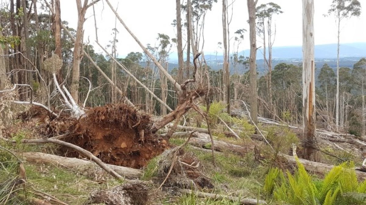 Uprooted tree from windthrow event in the Dandenong Ranges - photo by Annette Muir
Windstorm impacts on forests
Severe windstorms can cause extensive windthrow, causing trees to fall over through uprooting or breakage. Although windthrow is a natural disturbance in forests, their increasing frequency and severity under future climate scenarios may impact the health of our forests.
In June 2021, a severe windstorm in the Dandenong Ranges brought down thousands of large eucalypts in a windthrow event. The wind came from an unusual direction (south and southeast) with gusts reaching at least 120 km/h. It affected more than 220 hectares of forest, impacting Mountain Ash, stringybark eucalypts and Blackwood trees. There is uncertainty about the effects this event may have on regeneration of trees and understorey species, as there are few studies of windthrow in Australian temperate forests.
What we’re doing
ARI, in collaboration with DEECA Port Phillip Region, has set up monitoring plots to measure the regeneration of forest canopy trees and understorey plants over time. In Autumn 2022, surveys were undertaken in two windthrow areas that represented wetter and drier forest types in Dandenong Ranges National Park.
We collected data on standing trees, eucalypt seedlings, shrubs, ground covers, weeds, and fallen logs and branches. These areas were surveyed again in Summer 2024-2025 and compared with areas less affected by windthrow.
Additional control sites were established in areas with remnant canopy in 2025-2026 to help monitor the forest’s recovery into the future.
Key findings
Through this research we found:
- Understorey vegetation in the windthrow plots is showing a trajectory of recovery since the storm in response to increased light availability.
- By 2025, native wire-grass had the highest cover at the wetter forest site, whereas native shrubs were the dominant lifeform at the drier forest site.
- At the wetter forest site, eucalypt germination was limited by fallen logs and may not be enough to replace fallen trees.
- At the drier forest site, there are larger number of juvenile eucalypts as a result of the planned burn that preceded the storm, but future planned burns may impact their survival.
- Weeds such as Blackberry had a low cover, but these were slowly increasing and will need to be controlled to prevent further spread.
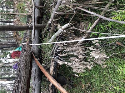
Surveying windstorm affected area - photo by Megan Pollock
What’s next
This monitoring program provides a baseline to measure how forests recover from a windstorm event. These records allow for the effects of future disturbances to be assessed and inform management activities such as planned burning. To achieve this, we plan to re-survey the monitoring plots in 2027 and 2032.
Publications
- Dandenong Ranges Windstorm: Forest Recovery Monitoring Factsheet June 2025 (PDF, 1.5 MB) (DOCX, 5.2 MB)
For more information contact research.ari@deeca.vic.gov.au

Monitoring site for windstorm monitoring - photo by Megan Pollock
Page last updated: 04/02/26