In short
|
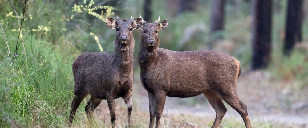
Sambar deer. Photo by Justin Cally.
Why wildlife managers need population estimates
To make informed decisions about the management of wild animal populations, wildlife managers need to understand where animals occur and how many there are across the landscape. When considering large areas, this can be difficult, and counting every animal is usually not feasible.
To address these challenges, ARI researchers use advanced statistical sampling methods. These can be at small, localised scales or across much larger areas, such as the whole of Victoria.
Researchers carry out carefully designed surveys to count or record the presence of animals at each of the sampled locations across a large area. The sampled locations are selected to closely represent all the habitat used by the species in question.
Using these survey samples, researchers then create statistical models that estimate numbers in areas that were not directly surveyed, allowing populations to be assessed across large landscapes. These models usually include environmental factors that influence the distribution of animal populations, such as climate, topography and variables describing habitat and vegetation.
Counting has its challenges
An important consideration when estimating population size is that animals can be difficult to count accurately. It is unlikely that all animals at each sampled location will be seen and counted, as they may be obscured by dense vegetation or be cryptic in nature.
Researchers overcome this challenge by using methods that account for this ‘imperfect’ detection, such as double-observer counts or distance sampling. These correction techniques produce more reliable estimates of the number of animals actually present.
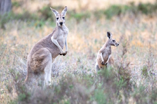
Red Kangaroos - photo by Justin Cally.
What we are doing
ARI undertakes many projects each year to estimate wildlife populations. We use tried and tested peer-reviewed methods, applying and adapting them to the Victorian context.
Our researchers are also improving existing statistical methods and developing new statistical methodologies and approaches. As more data becomes available about species and their habitats, we continue to refine these models.
Methods for population estimates
ARI uses several survey methods to estimate the abundance of wildlife populations, including ground and aerial surveys.
Wildlife populations can be estimated using aircraft or drones across a defined area. Observers record the number and location of animals seen along predetermined flight paths, known as transects.
In smaller areas with good visibility, a total count may be possible. More commonly, sample counts are conducted and the number of animals observed is extrapolated to the entire survey area.
Aerial counts are particularly useful for monitoring large mammals such as kangaroos in lightly forested areas and provide a cost-effective way to assess population trends over time.
ARI uses visual counts to estimate wildlife abundance by directly observing and recording animals within a defined survey area. Surveys may involve systematic searches along transects or use fixed observation points.
The number of animals detected is used to estimate abundance, often by calculating density and extrapolating it across the area of interest. Ground counts are particularly useful for species that are conspicuous, occur at relatively high densities or occupy accessible habitats.
This method has been used by ARI for monitoring waterbirds at the Western Treatment Plant and waterbird responses to environmental water.
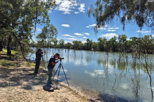
Bird surveys for Mallee Catchment Management Authority.
ARI uses remote infrared cameras to estimate wildlife populations using a cost-effective method called Camera Trap Distance Sampling (CTDS). To date, over 1,450 locations across the state have been monitored.
The method uses the distance between the target species and the infrared camera location to correct for imperfect detection due to the decline in detectability with distance from the camera’s infrared sensor. Statistical modelling is then used to estimate density, such as the number of animals per km2, at each camera location.
This estimate can then be extrapolated to the study area. The resulting data can be used to better assess the abundance and distribution of the target species locally, or even across the entire state.
ARI has used this method for statewide abundance estimates for deer, feral pigs and native species such as Dingoes.
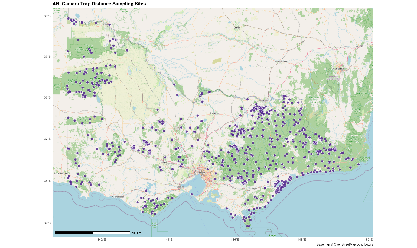
ARI’s previously sampled locations of CTDS abundancy estimations . Map by Justin Cally (ARI)
Project examples
ARI completed a statewide deer abundancy estimate (2021–2023) to assess the distribution, abundance and ecological impacts of deer in Victoria. Using the CTDS method, we surveyed for Sambar, Fallow, Red, and Hog deer at 317 sites across public land.
Camera trap data were combined with sign transects (counts of evidence of deer presence such as scats, prints or bark rubbings) and vegetation surveys.
Key findings:
- The deer populations on public land across Victoria were estimated at about 191,000 deer (90% CI: 147,000 – 255,000), with Sambar deer the most common species.
- Deer were widespread across Victoria’s public land, with Sambar predicted to occur across 38,582 km2 and at the highest densities in the northeast.
- Higher deer densities were associated with reduced native woody understory, increased weed presence and proximity to pastures.
These results provide baseline data and spatial mapping that can inform targeted management, ongoing monitoring and integration into statewide biodiversity reporting frameworks.
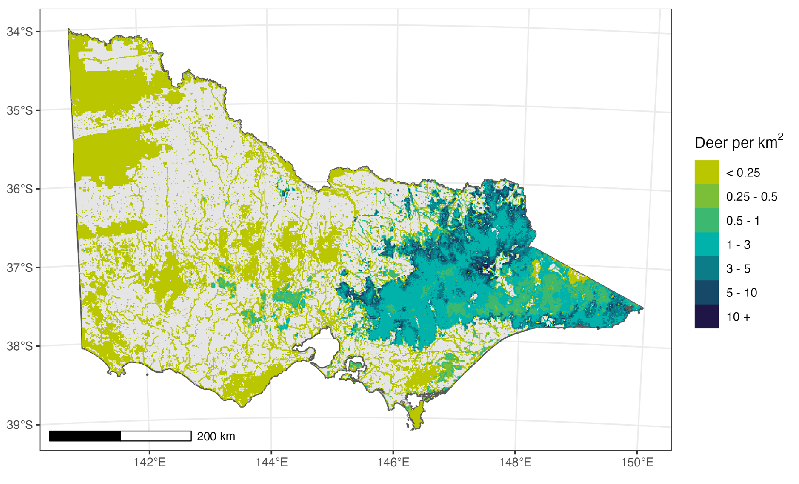
Spatial variation in Sambar deer density (deer/km2). Map by Justin Cally (ARI).
Publications:
- ARI Technical Report 378 (2025). Guidelines for monitoring Deer Populations (1.5 MB) (DOCX, 8.7 MB)
- ARI Technical Report 372 (2023). Abundance and population genetics of Hog deer (Axis porcinus) in Victoria (PDF, 2.2 MB. (DOC, 3.3 MB)
- ARI Technical Report 368 (2023). Abundance of deer in Victoria; Regional and statewide estimates of deer density and their impacts on vegetation (PDF 1.7 MB) (DOCX 1.9 MB)
In partnership with the Game Management Authority (GMA) , ARI is investigating the effectiveness of recreational hunting for managing introduced deer populations. The study will quantify how different hunting regimes influence deer abundance and the impacts of deer on vegetation condition.
Although recreational hunters harvest large numbers of deer annually, their contribution to population control remains unclear because of limited empirical evidence and a lack of population estimates .
The project uses a before-after-control-impact (BACI) experimental design; monitoring multiple sites where hunting access changes, alongside control areas with and without hunting. Data are being collected using the CTDS method to estimate deer density, and vegetation surveys to assess ecological impacts.
Findings will inform sustainable hunting policies and evaluate the role of recreational hunting in long-term deer management.
This project is funded by the Victorian Government’s Sustainable Hunting Action Plan and will be completed by 2028.
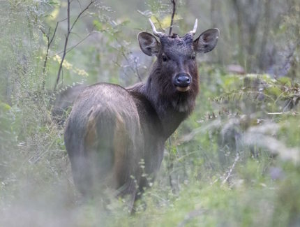
Sambar Deer. Photo by Justin Cally.
ARI delivers periodic population estimates of kangaroos to inform Victoria’s Kangaroo Harvesting Program (2024–2028). The program guides the sustainable commercial harvesting of Eastern and Western Grey Kangaroos and uses population estimates to guide harvest quotas.
Statewide aerial surveys using helicopters are carried out across agricultural land and lightly forested areas. ARI uses established transect survey methods, with updated model-based techniques employed to improve accuracy compared with previous approaches.
Because the two grey kangaroo species are difficult to distinguish from the air, a spatial model was used to apportion the estimates between them based on the overlap in the distribution of the two species.
Key findings:
- In 2024, the total grey kangaroo population was estimated at 2.3 million, including about 2.09 million Eastern Grey Kangaroos and 212,000 Western Grey Kangaroos.
- Eastern Grey Kangaroos made up roughly 83% of the population and increased from 1.76 million in 2022 to 2.09 million in 2024, an increase of about 18%.
- Western Grey Kangaroos decreased slightly over the same period, from 227,000 to 212,000, a decline of about 7%.
- The 2024 abundance estimate for Red Kangaroos was 39,000 (95 % CI 22,000-68,000). This species is not included in the Kangaroo Harvesting Program.
- Continued aerial surveys, periodic ground surveys and ARI’s modelling approaches are recommended to support effective population monitoring and management decisions.
Publications:
- ARI Technical Report 385 (2024). State-wide abundance of kangaroos in Victoria, 2024 (PDF, 2.4 MB). (DOCX, 6.1 MB)
- ARI Technical Report 384 (2024). Kangaroo harvest quotas for Victoria, 2025.
- ARI Technical Report 356 (2023). State-wide abundance of kangaroos in Victoria, 2022 (PDF, 0.8 MB). (DOCX, 6.1 MB)
- ARI Technical Report 349 (2022). Kangaroo harvest quotas for Victoria, 2023.
- ARI Technical Report 280 (2017). Design of an aerial survey to estimate the abundance of kangaroos in Victoria (PDF, 2.1 MB). (DOCX, 10.8 MB)
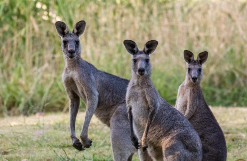
Eastern Grey Kangaroos. Photo by Andy Geschke.
In 2025, ARI studied the potential impact of disease risk to livestock from feral pig populations. This research conducted a statewide survey across 1,611 sites using Camera Trap Distance Sampling surveys.
Our research estimated Feral Pigs in Victoria at densities of 0–6 pigs/km², with a total population of 22,463 (90% CI: 14,300 – 33,599) on public land.
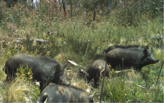
Feral pigs caught on a camera trap. Photo by DEECA.
ARI delivered statewide population estimates for dingoes using CTDS. This research is informing dingo management across Victoria.
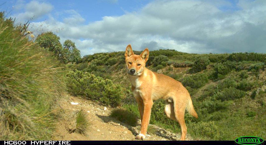
Dingo in the Bogong High Plains - photo by ARI.
Each year, ARI delivers the analysis for the annual Victorian game duck abundance survey in partnership with the Game Management Authority (GMA). Designed by ARI, the program combines aerial and ground counts to track population trends and improve our understanding of waterfowl ecology.
Using helicopters, more than 850 farm dams, natural wetlands, rivers and sewage ponds across the state are surveyed. Waterbodies are selected using a stratified random sampling design to ensure representation across different regions, waterbody types and sizes.
To complement these counts, satellite imagery is used to measure water availability in duck habitats. This information allows us to calculate statewide abundance estimates for each game duck species, making these ongoing estimates the largest-scale aerial surveys of game ducks ever undertaken in Victoria.
This research provides critical data for the GMA’s Adaptive Harvest Management, supporting evidence‑based decisions on sustainable duck hunting arrangements each year and the long‑term conservation of waterfowl populations.
Publications:
- ARI Technical Report 386 (2025). Abundance estimates for game ducks in Victoria 2024 (PDF, 2.5 MB) (DOCX, 5.3 MB)
- ARI Technical Report 376 (2024). Abundance estimates for game ducks in Victoria 2023 (PDF, 2.2 MB) (DOCX, 4.0 MB)
- ARI Technical Report 357 (2023). Abundance estimates for game ducks in Victoria 2022 (PDF, 1.8 MB) (DOCX, 9.2 MB)
- ARI Technical Report 335 (2022). Abundance estimates for game ducks in Victoria 2021 (PDF, 1.8 MB)
- (DOCX, 1.7 MB)
- ARI Technical Report 325 (2025). Abundance estimates for game ducks in Victoria 2020 (PDF, 2.4 MB)
- (DOCX, 12.5 MB)
For more information on game duck management research, visit the GMA’s Duck Research page.
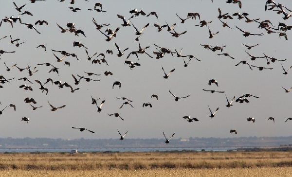
Ducks in flight over a wetland. Photo by ARI.
As part of the Victorian Sustainable Hunting Action Plan, ARI designed the state’s first abundance and distribution survey for Stubble Quail. The survey commenced in 2022 and is completed annually. This program provides critical data to improve understanding of the ecology and sustainable management of this native game bird.
Field data are collected using line-transect distance sampling. ARI scientists analyse the results and prepare annual abundance estimates. By tracking population trends across Victoria, this monitoring informs evidence‑based decisions about the sustainable management of Stubble Quail populations.
Publications:
- ARI Technical Report 391 (2025). Population estimates for Stubble Quail in Victoria - 2025 Report
- ARI Technical Report 379 (2025). Abundance estimates for Stubble Quail in Victoria - 2024 Report
- ARI Technical Report 360 (2025). Abundance estimates for Stubble Quail in Victoria - 2023 report.
- ARI Technical Report 342 (2025). Abundance estimates for Stubble Quail in Victoria - 2022 report.
For more information on game duck management research, visit the GMA’s Quail Research page.
=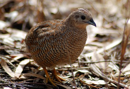
Brown Quail - photo by Bob Jenkin.
Four common cockatoo species in Victoria (Galah, Sulphur‑crested Cockatoo, Little Corella and Long‑billed Corella) are widespread and often cause damage to crops and property. They are frequently the subject of applications for control under Victoria’s Wildlife Act 1975 and are sometimes illegally killed.
Establishing credible estimates of cockatoo populations is needed to understand the ecological risks of these actions.
We analysed BirdLife Australia’s Atlas data (2010-2020) using advanced spatial and spatiotemporal modelling. Our results show that all four species are abundant and either stable or increasing across the state.
Population estimates for 2021 across Victoria were:
- Galahs at 13.6 million
- Sulphur‑crested Cockatoos at 7.7 million
- Long‑billed Corellas at 5.2 million
- Little Corellas at 2.9 million.
These robust estimates provide a strong foundation for assessing the impacts of current and future control measures. The methodology can also be updated as new data become available to track long‑term trends in abundance.
Publications:
- ARI Technical Report 328 (2021). Assessing the abundance of four cockatoo species in Victoria, 2021 (PDF, 2.3 MB). (DOCX, 4.1 MB)
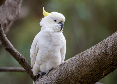
Sulphur-crested cockatoo. Photo by Andy Geschke.
In 2025, ARI completed a statewide survey to estimate Koala population across Victoria’s public land and plantations. This research is a key action under the The Victorian Koala Management Strategy.
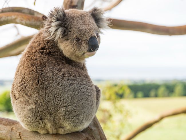
Koala. Photo by Justin Cally.
More information
For more information about ARI’s wildlife estimate research, contact Dr David Ramsey (david.ramsey@deeca.vic.gov.au).
ARI is also seeking to collaborate with other agencies to collate data from projects that have wildlife counts, particularly from camera data, to create a statewide database of species abundance estimates. Please contact justin.cally@deeca.vic.gov.au for more information.
Acknowledgements and partners
This research has been funded by the Victorian Government’s Game Management Authority and Department of Energy, Environment & Climate Action.
Page last updated: 15/09/26