In short
|
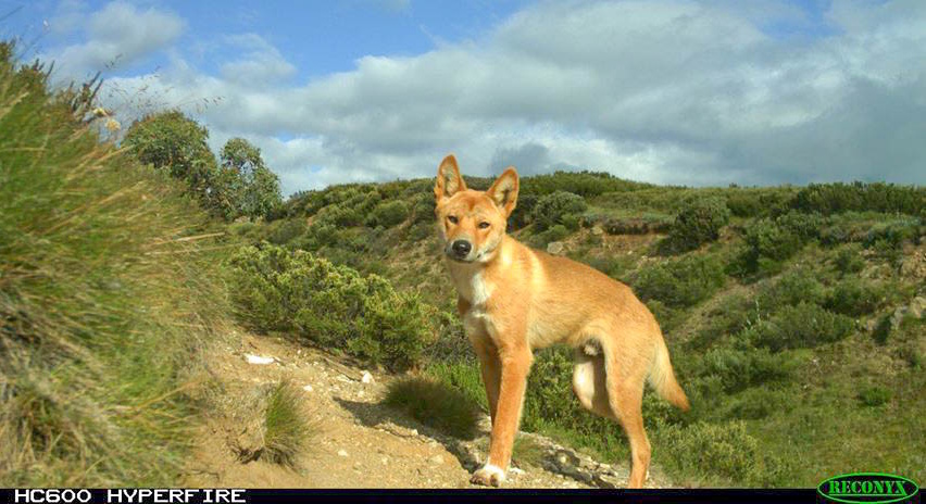 Dingo in the Bogong High Plains - photo by ARI.
Dingoes in Victoria
Dingoes hold deep cultural significance for many of Victoria’s First Nations Peoples, who often regard them as totemic animals, kin, and family. While dingoes are an important part of the natural and cultural landscape, they can also impact livestock, leading to economic and animal welfare concerns for rural communities.
In 2021, the dingo (Canis lupus dingo) was listed as Vulnerable in Victoria under the Flora and Fauna Guarantee Act 1988.
In 2024, the Australian Mammal Taxonomy Consortium and the Australian Museum updated the dingo’s scientific classification to Canis familiaris. Despite this change, the conservation status of dingoes in Victoria is unaffected by the revised scientific name, and it is broadly recognised that dingoes have been present in Australia for thousands of years prior to European colonisation and are considered to be native wildlife and therefore, protected under the Wildlife Act 1975 in Victoria.
Recent genetic investigations indicate that hybridisation between free-ranging dingoes and domestic or feral dogs in Victoria appears to be very low. This challenges the previous assumptions and has prompted new research to guide the future management of Dingoes in Victoria.
What we are doing
ARI is leading multiple research projects to better understand the distribution, genetics and behaviour of dingoes in Victoria.
Dingo population estimates
In 2022-23, ARI conducted a large-scale survey to estimate the dingo population across Victoria using remote infrared cameras (camera traps) placed at 357 sites on public land.
Key findings:
- The estimated dingo population across Victoria is 5,010 individuals (90% credible interval: 2,710–9,050).
- The Gippsland and Hume regions support most of Victoria’s dingoes, estimated at 4,900 individuals (90% credible interval: 2,640–8,880).
- In the Big Desert Wilderness Park and Wyperfeld National Park (BD/WNP) region, the dingo population is estimated at 110 individuals (90% credible interval: 40–230).
- Rainfall and ruggedness of terrain were predictors of dingo abundance, possibly reflecting the distribution of their prey species.
- Dingoes were less likely to occur further from permanent water, suggesting water availability plays a key role in their distribution—particularly in arid regions like BD/WNP.
ARI used a scientifically robust survey method, estimating dingo density by pairing encounter rates of dingoes in photos and the distance from camera measurements. The environmental and climate characteristics of each camera trap location was used to understand how dingo densities vary across the state. This information allowed for the density of dingoes to be extrapolated and estimated for the areas that were not directly sampled with cameras.
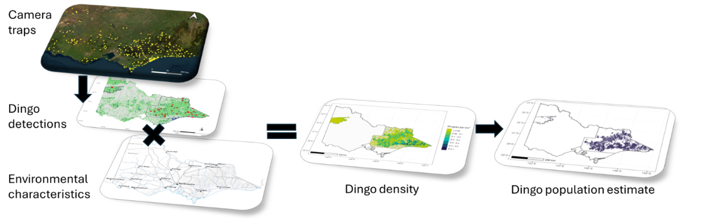
Schematic of the datasets used to estimate dingo population for Victoria. Camera traps are placed across Victorian public land, each camera captured detections or absence of detection. This is then linked to the environmental characteristics so that dingo density could be modelled more broadly. Dingo densities were applied across the public land area to estimate the dingo population.
For more information you can access the Technical Report ‘The abundance of dingoes Canis familiaris (Dingo) in Victoria’.
Current research surveys
The statewide survey of Dingoes is being repeated in late 2025 to early 2026. This will help determine whether there have been any population changes since the initial survey. As part of the revised survey design, 136 cameras will be deployed in the east of the state with 50 cameras being deployed in the Big Desert Wilderness Park and Wyperfeld National Park region. Results from the survey are expected to be available in early 2026.
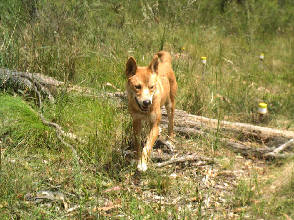 Dingo on camera trap - photo by ARI.
Population Viability Analysis
ARI has developed a spatially explicit, individual-based model to better understand dingo populations. This model captures key aspects of dingo social behaviour, including:
- pack dynamics
- territorial behaviour
- links between reproduction and pack structure
- movement patterns influenced by habitat features.
ARI is updating the model parameters with data from the northwest dingo population to create a practical tool to estimate the likelihood of extinction for dingoes in northwest Victoria. By simulating different management scenarios, the tool will help land managers and decision-makers assess how various strategies could impact the persistence of the species in northwest Victoria.
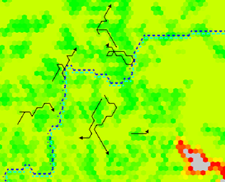
Example of dingo movements (black arrows) simulated in relation to landscape characteristics (colours of hexagon codify different levels of habitat suitability) and landscape features (dotted line indicates a dog-proof fence).
Standardised forensic protocol
ARI is developing new protocols to improve how predator species are identified following livestock attacks. These standards aim to ensure consistent, reliable data collection and confirmation of the species responsible.
The protocols will cover:
- Morphological data collection – including recommended methods and a standardised template for recording and storing observations.
- Molecular forensic sampling – involving the collection of DNA traces from predator saliva found around wounds.
These protocols will support both targeted sampling and opportunistic data collection by field staff. They will also help inform management decisions by providing a consistent framework for evidence-based assessments.
Publications
- Technical Report 382 (2025) The abundance of dingoes Canis familiaris (Dingo) in Victoria: Results from a statewide survey. (PDF 1.3 MB) (DOCX 2.7 MB)
For more information contact research.ari@deeca.vic.gov.au
Acknowledgements
This research was funded by the Victorian Government through the Department of Energy, Environment and Climate Action .

Page last updated: 23/03/26