Water for the environment, or ‘environmental water', is water that is released into rivers, floodplains, wetlands and estuaries to improve waterway health and protect environmental values. Over the past 200 years, the water regime of many Victorian wetlands has been highly modified, with changes to the frequency, duration and timing of flooding causing a decline in wetland condition. To redress this problem, environmental water is being used to re-establish a more natural water regime and improve the health of priority wetlands across the State.
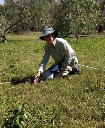
The Wetland Monitoring and Assessment Program (WetMAP) is measuring the response of wetland vegetation and a range of fauna to the delivery of environmental water. The findings of this work are helping to use environmental water more effectively; prioritise watering locations across the state; identify the types of water regimes needed to support wetland biodiversity; and assist with reporting for the Murray-Darling Basin Plan.
The program is being delivered in a series of stages, with ARI leading delivery of stages 3 and 4. This approach allows for learnings to inform the program over time.
Information on each stage is presented below with associated resources. For more information about WetMAP contact:
Rob.hale@delwp.vic.gov.au (WetMAP Program Manager, DELWP Water and Catchment Group)
Magdalena.Nystrand@delwp.vic.gov.au (WetMAP Program Coordinator, ARI)
Nyil.Khwaja@delwp.vic.gov.au and Danny.Rogers@delwp.vic.gov.au (bird theme, ARI)
Lyndsey.Vivian@delwp.vic.gov.au (vegetation theme, ARI)
WetMAP Stage 4 (2020-2024)
Following WetMAP Stage 3, the approach to management and governance was revised, seeking to have a more coordinated and combined approach to program delivery and governance. A new Program Steering Committee and a new Independent Scientific Review Panel (ISRP) were established with revised Terms of Reference and membership. Extensive consultation has occurred with key stakeholders within catchment management authorities and the Victorian Environmental Water Holder. A suite of project proposals has been developed, reviewed and prioritised according to stakeholder and scientific input.
The following projects, within the Bird, Vegetation and Fish themes are now underway. These projects vary in terms of when they commenced, their size and timeframe (i.e. some are short term, desk-based review projects, while others are longer-term and involve field based monitoring).
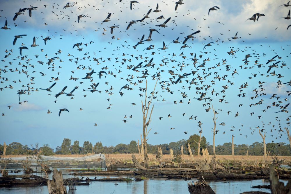
The WetMAP bird theme includes three projects which involve:
- investigation of how waterbird numbers vary across seasons and how this may affect responses to environmental water ((PDF, 1.2 MB), (DOCX, 22.3 KB))
- investigation of the habitat requirements of waterbirds and the water regimes required to support this habitat ((PDF, 3.2 MB), (DOCX, 26.9 KB))
- tracking waterbirds to quantify their use of wetlands that receive environmental water ((PDF, 805.9 KB), (DOCX, 26.7 KB)).
The WetMAP vegetation theme includes two projects which involve:
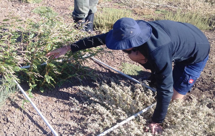
- updating knowledge on the ecology, distribution and physiology of Tall Marsh, including the evaluation of the success of past Tall Marsh management. The output from this project will inform future management of these species ((PDF, 2.2 MB), (DOCX, 38.8 KB)).
- investigating the seasonal timing of inundation on wetland plant composition and growth. This work includes a workshop (held in December 2021) and synthesis of current knowledge and implications for autumn watering.
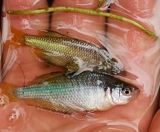
The WetMAP fish theme currently has one project on Murray Hardyhead which includes ongoing monitoring as well as an analysis and evaluation of existing spawning and recruitment data.
In addition, monitoring the condition of vegetation, bird and frog communities is occurring at a range of wetlands, building on data previously collected to contribute to our understanding of the benefits of environmental water. (Wetland Monitoring 2022-24, (DOCX, 1.8 MB)
WetMAP Stage 3 (2017-2020)
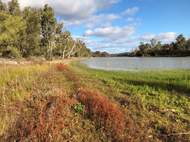
Many aspects of wetland ecology were studied during WetMAP Stage 3, including tree condition, diversity of plants, numbers and breeding activity of waterbirds, fish and frogs. A total of 66 wetlands were surveyed, with 22 wetlands surveyed for vegetation, 30 for frogs, 25 for birds and 15 for fish.
Overall, positive responses of native biota to environmental water were detected. Stage 3 represents a starting point, recognising that the responses of many biota to environmental water and water regimes are complex and influenced by longer time periods, and multiple watering events.
- Increased both native wetland plant cover and richness, and reduced terrestrial plant cover
- Increased frog species abundance and richness. While there were few breeding records, they all occurred in watered wetlands
- Increased habitat available for wetland birds and their abundance and richness. Additionally, breeding was only observed at watered sites
- Boosted seasonal fish numbers compared to wetlands not receiving environmental water
- Increased connectivity, providing opportunities for fish to move between wetland and rivers
- Supported the survival of the critically endangered Murray Hardyhead, by providing appropriate salinity levels for successful breeding.
Our research found that environmental water events:
The Stage 3 final report provides a synthesis of the approach taken and key findings and includes summaries for all core areas of monitoring and research.
- Papas, P., Hale, R., Amtstaetter, F., Clunie, P., Rogers, D., Brown, G, Brooks, J., Cornell, G., Stamation, K., Downe, J., Vivian, L., Sparrow, A., Frood, D., Sim, L., West, M., Purdey, D., Bayes, E., Caffrey, L., Clarke-Wood, B. and Plenderleith, L. (2021). Wetland Monitoring and Assessment Program for environmental water: Stage 3 Final Report (PDF, 6.6 MB). Arthur Rylah Institute for Environmental Research Technical Report Series No. 322. Department of Environment, Land, Water and Planning, Heidelberg, Victoria.
(accessible version ((DOCX, 9.2 MB)))
Page last updated: 15/05/25