Regional Forest Agreements (RFAs) are agreements between the Commonwealth and state governments that establish the framework for the management of forests in an RFA region. DELWP is currently updating the agreements, as well as Victoria’s forest planning and regulatory framework, to ensure they provide for sustainable forest management for the future.
ARI is supporting this process by contributing to updated assessments of forest values, including landscape-scale surveys for threatened species, habitat modelling, more accurate and detailed forest structure modelling, and forest type information. See below for more information on the five components that ARI are leading:
- Forest stem age distribution model for East Gippsland
- Primary rainforest mapping
- Landscape-scale surveys for threatened species
- Habitat distribution models for forest-dependent species (updating v2014)
- Integrated biodiversity values model
For more information on the RFA process see the DELWP Regional Forest Agreements website. A series of fact sheets on RFA assessments are also available.
Forest stem age distribution model for East Gippsland
In eucalypt forests, the age distribution of tree stems is a useful indicator of a forest’s capacity to support species that depend on older forests. Specifically, this relates to the development of a diversity of tree hollows that are typical of ‘older’ eucalypt forests. As such, the ‘structural’ diversity of Victorian forests in both space (i.e. across landscapes), and over time, is important when considering the conservation of a range of plant and animal species, especially for those dependent on the existence, arrangement and recruitment of older forests. Repeatable and quantitative modelling of the extent, type and intensity of past forest disturbances is important for managing the conservation of sensitive species.
ARI has developed a dynamic model of stem ages for the East Gippsland RFA region that accounts for the impacts of forest disturbances (fire and timber harvesting) on the dominant tree species for the period 1987 to 2018. The model integrates four sets of data:
- A spatially explicit estimate of forest stand ‘age structure’ as at 1987 (i.e. starting age).
- A spatially explicit estimate of forest species composition (including both eucalypt and non-eucalypt tree species).
- A set of annual models that track the timing, intensity and type of forest disturbance (fire and timber harvesting) from 1988 to 2018.
- A set of ecological responses for each of 58 East Gippsland tree species within four age classes (juvenile, sapling, adult, senescent) to three different levels of fire intensity (low, medium and high), and timber harvesting activities.
The complete dataset will allow for subsequent analyses of forest age, species mix and disturbance history that were previously not possible. The database can also map the sensitivity of the forest to the type, intensity and timing of disturbance events over the last 30 years.
For more information contact: graeme.newell@delwp.vic.gov.au
A DELWP fact sheet on old growth forests is also available.
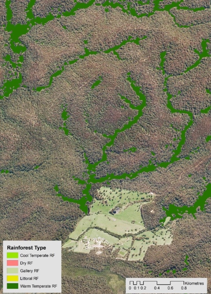
Primary Rainforest Extent and Type Mapping for Victoria
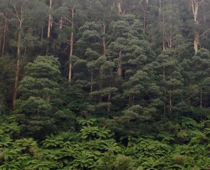
Rainforest arises in environmentally stable landscapes where high intensity fires have been absent for extended periods. Rainforest and related vegetation forms in Victoria are both naturally rare and susceptible to ongoing disturbances including bushfires, timber harvesting and disease. ARI combined modelling using satellite image composites, species distribution modelling and interpretation of high-resolution aerial photography to create a map of rainforest extent and type across most of Victoria.
Machine learning algorithms were used to model the distribution of primary rainforest, using training data from known extant rainforest stands and multi-spectral satellite imagery. Locations identified as potential rainforest by the model were checked, edited and augmented through the interpretation of high-resolution aerial photography.
This mapping will be used to inform an updated estimate of the amount of rainforest in Victoria and a baseline for measuring change in rainforest distribution over time.
For more information contact: matt.white@delwp.vic.gov.au
The following report provides more detail:
- White, M., Bhatpurev, K., Salkin, O. and Newell G. (2019) Primary Rainforest Mapping in Victoria 2018 - extent and type. (PDF, 9.1 MB) Arthur Rylah Institute Technical Report Series No. 309. Department of Environment, Land, Water and Planning, Heidelberg, Victoria
(accessible version (DOCX, 1.8 MB))
A DELWP fact sheet on mapping Victoria’s rainforests is also available
Landscape Scale Survey Program
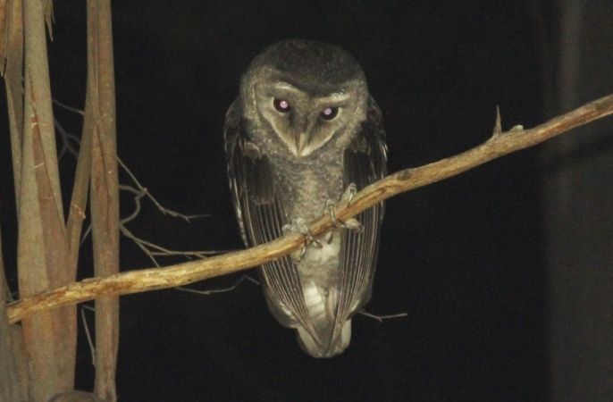
ARI’s researchers are undertaking extensive surveys of 53 priority forest-dependent species across eastern Victoria, with surveys targeting threatened marsupials, owls, cockatoos, crayfish, galaxiids, frogs and plants. Survey sites are selected to address critical gaps in existing occurrence records specifically to reduce uncertainty in habitat distribution models (see below). For many species this will improve our understanding of the species' distributional limits, occurrence in marginal habitats and response to disturbances such as fire and timber harvesting.
Surveys are being tailored specifically for each species and the information required, and involve a variety of techniques:
- camera traps - in trees (Leadbeater’s Possum) and ground-based (Long-footed Potoroo)
- spotlighting (Greater Glider and Yellow-bellied Glider)
- acoustic playback (Powerful, Sooty and Masked Owls)
- identification of characteristically-chewed Black Sheoak cones (Glossy Black-Cockatoo)
- electrofishing (threatened forest-dependent galaxiids and spiny crayfish)
- burrow tube traps (burrowing crayfish)
- frog and tadpole searches, and acoustic recorders (Large Brown Tree Frog and Giant Burrowing Frog)
- vegetation surveys (threatened plants, e.g. Gippsland Stringybark).
Improved survey information about where different species occur will support improved management of threatened species at both the site and landscape scale, and ensure that the modernised RFAs are based on the best available information.
All species that are detected during these surveys, including other threatened and non-threatened species, will be recorded to increase our understanding of the suite of species that occur in these forests.
For more information contact: lindy.lumsden@delwp.vic.gov.au
A DELWP fact sheet on threatened species and an ARI fact sheet on galaxiids and crayfish is also available:
Updating Habitat Distribution Models (HDMs)
HDMs predict where suitable habitat may exist for a species, based in part on verified observations of the species in their natural environments. Existing HDMs for 77 species (produced in 2014), including 10 of high-priority, will be updated using new field data collected in the Landscape Scale Survey Program, the Forest Protection Survey Program and recently-collected data available from the Victorian Biodiversity Atlas.
The revised HDMs, particularly those that reflect the distribution of suitable habitat for high priority forest-dependent species, will help inform land-use planning, conservation reserve management and invasive species management. The updated distribution datasets will also be used in population viability analysis modelling which uses the current and future location and extent of habitats suitable for threatened species to determine the viability of populations under various disturbance and climate scenarios.
For more information contact: graeme.newell@delwp.vic.gov.au
Integrated Biodiversity Values Model (Stage 1)
ARI has created a model that provides indicative spatial representations of relevant biodiversity values. These values can be used to support structured decision-making for forest and fire management planning, including supporting RFA processes. The integrated biodiversity values model, based on existing habitat distribution models (HDMs) spatially represents the distribution of biodiversity features in Victoria’s forests, particularly the threatened species that depend on forests for persistence and are considered to be susceptible to timber harvesting operations. A suite of 35 terrestrial and 23 aquatic species were included in the development of the initial model. Furthermore, the model integrates these layers to form a single spatial layer of accumulated biodiversity value. It is designed to inform the policy implementation question: what areas of the forest estate should be prioritised for conservation, given:
- The distribution of biodiversity values, and
- The predicted future state of biodiversity under scenarios of disturbance, specifically fire regimes under climate change?
The Stage 1 products delivered for this project, especially for the predicted future state, are intended to illustrate data sets and tools that are suitable for identifying areas of the forest estate that should be prioritised for conservation. However, further development is needed before this policy implementation question can be comprehensively answered. Subsequent stages of the structured decision-making process are expected to involve more detailed evaluation of the consequences of different management strategies on biodiversity values.
For more information contact: cindy.hauser@delwp.vic.gov.au
Page last updated: 28/11/25